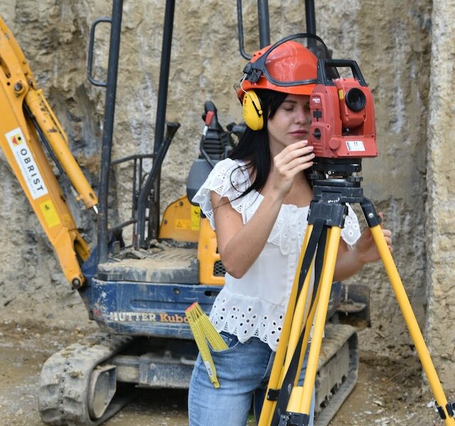
Geodesy is the science of precisely measuring and recording three of the earth’s basic properties, including its geometrical features, its spatial orientation, and gravity, as well as how the changes in these properties vary with time.
Geodesists use GPS to monitor the movement of a particular area around the clock and throughout the week. When applying geodesy to other planets, it’s called planetary geodesy, which involves the study of other astronomical bodies like planets or circumplanetary systems.
That said, below are ways in which geodesy is of importance to us:
#1. Accurate Representation of Topography Maps
Topography or land surface elevation finds vital scientific applications in geology, botany, zoology, erosion, hazards, etc. Data from topographic maps are one of the most important factors in determining the degree of flooding, base flood elevation, and water surface elevations and hence the accuracy of flood maps in riverine regions.
Similarly, accurate topographic maps – which are products of geodesy – can help us in aircraft navigation and recreational activities like backpacking and hiking. Through geodesic information, Google Earth© regularly updates its base layer with the latest topographic data. With accurate topographic information, commercial activities like planning pipelines, cell phone tower placement, and vehicle routing to economize fuel are now more efficient.
Modern US topography is now done with a higher accuracy of 10cm or better, thanks to aircraft radar and other precise geodetic infrastructure.
#2. GPS (Global Positioning System) Monitoring and Improvement
Geodetic infrastructure has contributed significantly to improvements in the GPS (Global Positioning System). For instance, through geodesic research, there’s now a third GPS frequency. Also, future GPS satellites can have laser retroreflectors – used to accurately determine the orbits of satellites around the Earth.
Also, NASA’s GDGPS (Global Differential GPS) performs integrity monitoring and GPS situational assessment for the US Defence Department. This GDGPS is the foundation for real-time orbit improvement for the Advanced Control Segment – an Air Force-sponsored project to improve GPS accuracy.
#3. Space Exploration
Aside from earthly applications, geodesy remains very relevant in the exploration of the solar system and other regions. Since geodetic systems have worked well on Earth, they can also be applied to extraterrestrial bodies.
For instance, the Gravity Recovery and Interior Laboratory (GRAIL) project utilizes a technique for determining the moon’s gravity that was developed by the Gravity Recovery and Climate Change (GRACE) project based on Earth. Before having the opportunity for in-depth study of the earth or other planets, we must depend on information from surface observations like geodetic and seismic measurements to grasp their interior structure.
The precession of the rotation axis of Mars has been measured, and its terrain and gravity field have been mapped through geodetic techniques. Through these observations, scientists now have estimates of the mass, size, and physical state of its core.
Also, there are estimates of the seasonal variations of mass in its polar ice caps. In the aviation industry, geodesic infrastructure is also necessary to track spacecraft locations from Earth because as spacecraft get farther away from the Earth, there’s an increase in the demand for accuracy in the angular resolution of tracking.
#4. Real-Time Geodetic Positions
Through geodesy, we can get accurate real-time locations, which are useful in a wide array of commercial services and applications. The accurate positions of GPS/GNSS (Global Navigation Satellite System) satellites in their orbits and a frame of reference from Earth are used to accurately determine an object’s location on the Earth’s surface.
The global geodetic infrastructure enables accurate real-time positioning for applications and services like surveying, and precision agriculture, through networks like the NOAA/NGS CORS (Continuously Operating Reference Station).
The CORS network is also a vital part of the NSRS (National Spatial Reference System) – which gives a very consistent and accurate geographic reference framework throughout the US, enabling the integration and registration of various data layers in the geographic and land information systems.
#5. Determining Accurate Satellite Orbits
Satellites are now equipped to provide a good number of vital services such as communications, weather forecasts, land-use monitoring, etc. It is possible to determine exactly where a satellite is in its orbit by simply attaching a GNSS/GPS receiver to it.
So, when the highest accuracy is needed, it becomes necessary to support the GNSS/GPS data with information obtained from global geodetic infrastructure like the ITRF (International Terrestrial Reference Frame) and the International GNSS Service network.
Additionally, geodetic observations contribute to the development of models of Earth’s gravity field, as well as the Earth’s rotation rate and rotation axis, which help to determine the gravitational forces on the satellite. That way, satellites can be positioned accurately for various applications like radar imaging, radar and laser altimetry, gravimetry, etc.
Final Thoughts
Geodesy has significantly impacted modern-day geology, surveying, astronomy, aeronautics, meteorology, and thus human life and existence. The above are only some of its present applications. Research is still ongoing in future use cases of this science and how it can improve human life on Earth and beyond.


